Linden Hills, Minneapolis: How a Streetcar Neighbourhood on Lake Harriet Grew Its Village Feel

Linden Hills sits on a rise between two of Minneapolis's best-known lakes, and it has long been described as a village inside the city: a compact shopping street, a branch library, a lakeside bandshell and a heritage streetcar that still runs on summer evenings. None of that happened by accident. The shape of the neighbourhood was set by a streetcar line, a park system and a burst of building in the 1920s.
Where Linden Hills is
Linden Hills is one of the neighbourhoods of the Southwest community of Minneapolis. Its edges are easy to picture on a map: Bde Maka Ska (the lake formerly called Lake Calhoun) and West 36th Street to the north, Lake Harriet and William Berry Parkway to the east, West 47th Street to the south and France Avenue, the border with Edina, to the west. Southwest High School sits on its southern edge. The neighbourhood covers about 1.4 square miles, and the 2020 census counted roughly 7,800 residents, according to Minnesota Compass, the data project run by Wilder Research.
The name is usually explained by the linden (basswood) trees and the rolling ground the early developers found here. The Linden Hills Neighborhood Council, the volunteer association recognised by the city, keeps a short history of the area and is the best starting point for anyone who wants to dig deeper.
Cottages, then a streetcar
Until the 1870s and 1880s, most of this land was open ground with a scattering of summer cottages. Minneapolis was growing fast along the Mississippi, and the lakes to the southwest were a place to escape the city rather than live in it. What changed that was transport. A street railway reached the lakes in the 1880s: according to the City of Minneapolis landmark record, the tracks of what became the Como-Harriet line were first used by horse-drawn cars in 1884 and by electric streetcars in 1891.
The line eventually linked Lake Harriet with downtown Minneapolis and, through the wider Twin City Rapid Transit network, with St. Paul. Once a household could ride to work downtown, a lot on the hill above Lake Harriet stopped being a holiday plot and became a commuter's home. Many of the early cottages were replaced over the following decades by the bungalows, foursquares and Tudor-style houses that line its streets today.
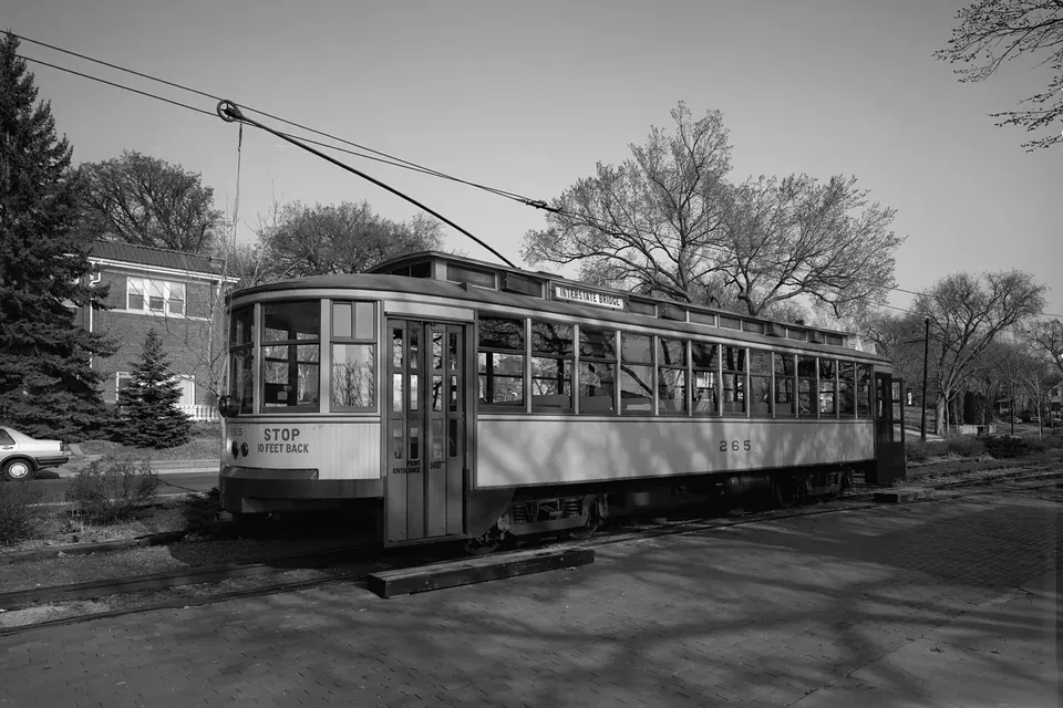
Streetcars stopped running in the Twin Cities in 1954, when buses took over. Part of the old right of way between Lake Harriet and Bde Maka Ska survived, and in 1969 volunteers relaid track on it. The restored car No. 1300, built in 1908, returned to service in 1971. The Minnesota Streetcar Museum runs it on about a mile and a half of the original route, with its station near West 42nd Street and Queen Avenue. The line was listed on the National Register of Historic Places in 1977 and designated a Minneapolis landmark in 1986.
A shopping street built for the streetcar
The commercial heart of the neighbourhood, around West 43rd Street and Upton Avenue South, grew up along the streetcar line in the 1920s. That is why it feels the way it does: shopfronts set right on the pavement, a few blocks long, with homes beginning almost immediately behind them. It was designed for people arriving on foot from a streetcar stop, not for cars looking for a parking lot.
Two public buildings anchor the area. The former Minneapolis Fire Department Station 28, in the business district, is listed on the National Register of Historic Places and has been converted to other uses. A few steps away, the Linden Hills branch of the Hennepin County Library, at 2900 West 43rd Street, occupies a building that dates from 1931. A smaller cluster of shops lies along West 44th Street, closer to France Avenue.
The neighbourhood's eastern edge is parkland. The lakeshore is part of the Minneapolis park system, run by the Minneapolis Park and Recreation Board, and the Lake Harriet Bandshell is its best-known landmark. The current bandshell, built in 1985, is the fifth on the lake: two predecessors burned, one was destroyed by a windstorm, and the fourth was demolished to make way for the present one. Free summer concerts there are a long-standing local habit.
The food culture of a walking neighbourhood
A district built around a streetcar stop tends to keep a particular kind of food culture: places you walk to rather than drive to, open for a coffee, a loaf, a weeknight meal or an ice cream after a lap of the lake. Linden Hills has had that pattern for decades. Restaurants and shops change hands, close and reopen under new names, so this guide does not review or rank them. Our advice is simpler: walk the few blocks around 43rd and Upton, look at what is open that season, and check each business's own website for current hours before you make a special trip.
Two regular fixtures are easier to plan around. The neighbourhood has a summer farmers market on Sundays; for the 2026 season, local listings gave a Sunday morning schedule from May to October near West 43rd Street. Our guide to Twin Cities farmers markets lists the larger markets with their official sites. And the lakes themselves are part of the routine: many residents' idea of a food outing is a picnic on the Lake Harriet shore after a stop at a bakery or grocery.
How to get there and get around
For most of the twentieth century, the bus that replaced the streetcar on Hennepin Avenue was the main transit link. In December 2025, Metro Transit opened the METRO E Line, a bus rapid transit route between the University of Minnesota and Southdale in Edina that runs along University and Hennepin avenues and then via West 44th Street and France Avenue. It replaced the old Route 6. Check metrotransit.org for stops and timetables; our guide to getting around the Twin Cities without a car covers the wider network.
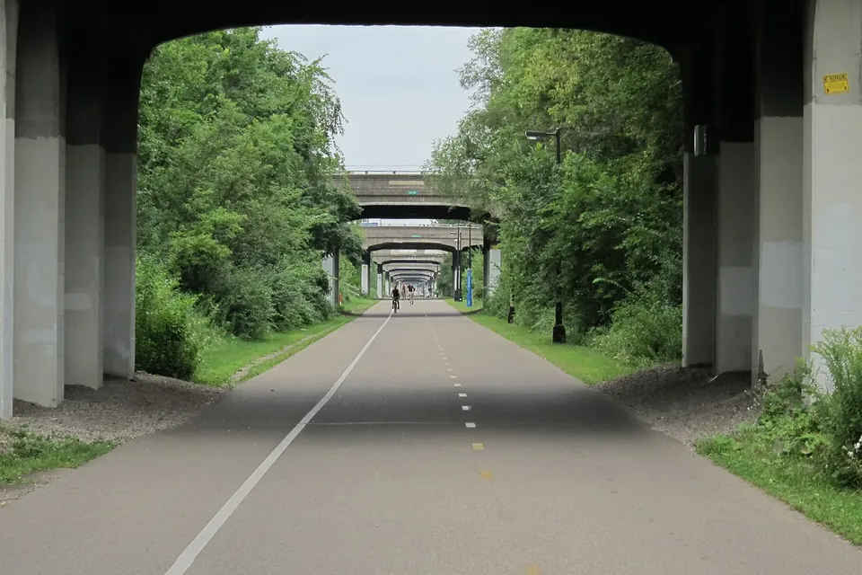
On foot or by bike, the paths around Lake Harriet and Bde Maka Ska connect to the city's Grand Rounds parkway system, so it is easy to combine a visit with a ride or a walk along the lakes.
Plan a visit
- Start at the streetcar station near West 42nd Street and Queen Avenue (the museum publishes its season and hours each year).
- Walk south to the shops around 43rd and Upton, then east to the bandshell on Lake Harriet.
- Check opening hours on each business's own site: they vary by season.
Thinking of moving here?
Linden Hills is mostly a neighbourhood of houses, with apartments concentrated near the commercial streets and along the main roads. If you are considering renting here or elsewhere in the city, our guide to what to know before you rent in Linden Hills and other Minneapolis neighbourhoods explains rental licensing, tenant rights and rent figures, with official sources.
Sources
- City of Minneapolis, Heritage Preservation: Como-Harriet Streetcar Line landmark.
- Linden Hills Neighborhood Council: neighbourhood boundaries and history.
- Minnesota Compass (Wilder Research): Linden Hills neighbourhood profile.
- Minnesota Streetcar Museum: Como-Harriet line and car No. 1300.
- Metro Transit: METRO E Line opening.
- Minneapolis Park and Recreation Board: Lake Harriet and the bandshell.
 Living here
Renting in Linden Hills and beyond
Rental licences, deposits, notice rules, Census rent figures and transit: the checks to make before signing a Minneapolis lease.
 Living here
Getting around without a car
Light rail, the new bus rapid transit lines, the Greenway and the Grand Rounds: how to reach the Twin Cities' food streets car-free.
 Markets & seasons
Twin Cities farmers markets, 2026
The big markets and the neighbourhood ones, with their published 2026 days, hours, addresses and winter schedules.